

Rezoning Information
On behalf of Brookfield Residential, ground cubed planning has submitted a Land Use Amendment / Outline Plan (Rezoning) application for the Jacques Lodge site.
This rezoning sets the stage for a unique development within Calgary, providing new housing choices in transit-supportive forms as well as new active mobility connections and parks. Knitted into the dramatic topography of the inner southwest, this development will facilitate an unparalleled living experience.
Click here to view the application’s status with The City of Calgary.
Housing Types
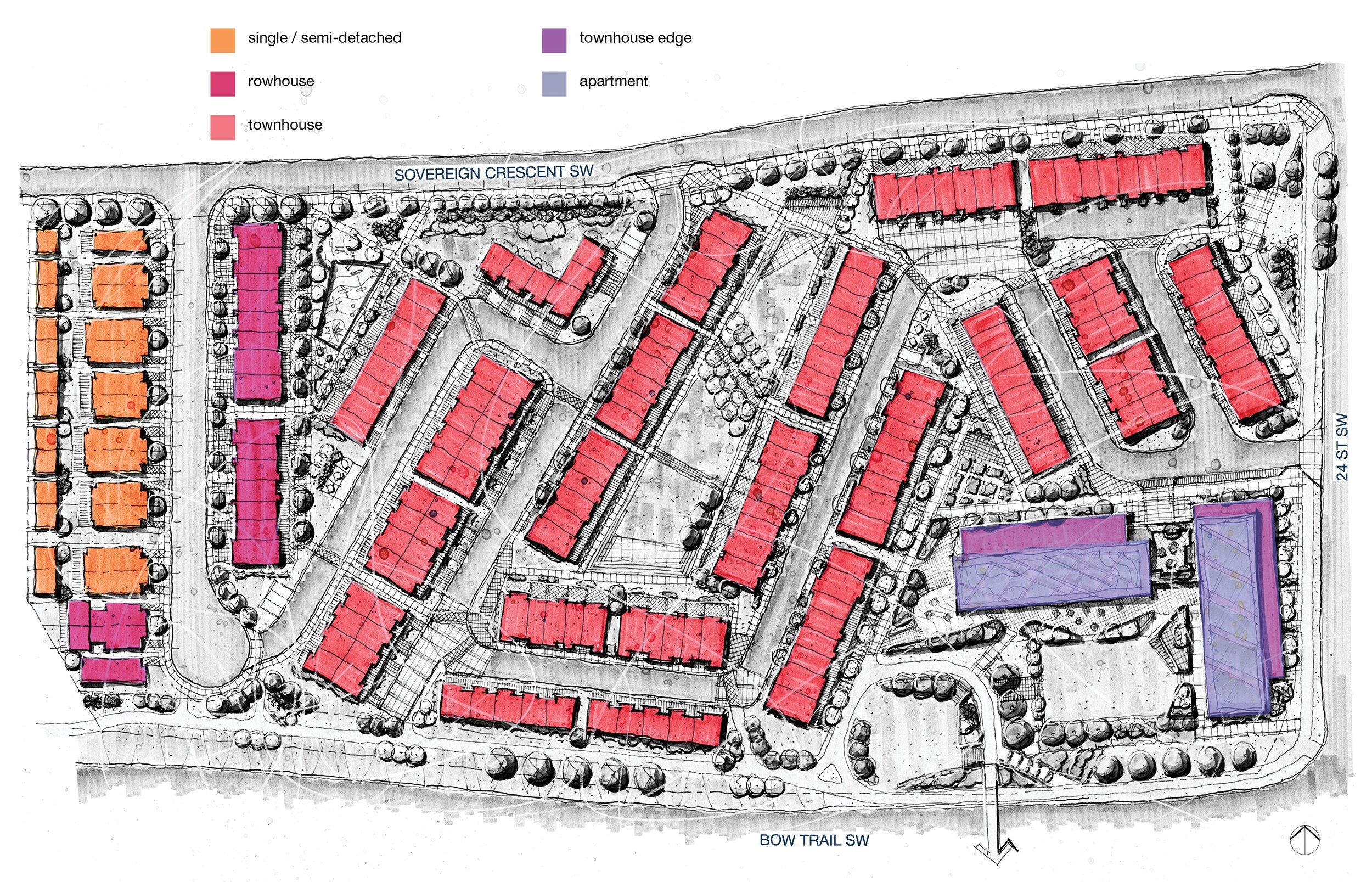
The housing types we have sought in our application include apartment units, stacked townhouse units / flats, up/down townhouse units, rowhouses, and semi-detached units. There also may be potential for several single detached units. Providing this mix of housing types will allow for people with varying preferences and lifestyle needs to live within the same community, facilitating housing choice and diversity.
Parks
Our application includes a significant amount of land devoted to parks and open space. The parks and open spaces are intended to be provided through a combination of Municipal Reserve dedication and the provision of publicly accessible and privately owned open spaces. The design intent is for all parks and open spaces to be welcoming and accessible to all, and for there to be a seamless integration between public open space (i.e., Municipal Reserve) and the other open spaces.

Land Use Districts
Given the slope of the Jacques site and the unique vision for its development, we have applied for a Direct Control District for the majority of the site. Our application seeks several housing types to be allowed for in this Direct Control District, in accordance with our Housing Types Concept. In addition, our application seeks to dedicate land to Municipal Reserve and accommodate City infrastructure through Special Purpose Districts.

Transportation
Our application proposes a street network consisting of one new public street (at the west edge of the site) as well as an internal private street network. Three vehicle access points are proposed for the site. These multiple access points are intended to disperse traffic throughout the network and to provide convenient connections.

Walking + Cycling
Given the site’s inner-city context and its connections to transit and cycling infrastructure, active mobility is a key focus of the application. Where possible, homes are proposed to have direct entrances from the park spaces, which will create an urban feeling and will encourage pedestrians to use the park spaces (rather than the streets) to navigate the neighbourhood. This will also provide a unique pedestrian experience and enhance safety.
Our application also proposes to fill in a key missing link in the cycling network in the area, particularly along the southern edge of the site near Bow Trail. We intend to provide a multi-use pathway along the southern and eastern edges of the site, providing safe and efficient bike connections.

Public Transit
The Jacques site has excellent access to public transit, with the Shaganappi LRT station located within approximately 100 metres of the southwest portion of the site. Local bus routes also provide convenient connections to local and regional destinations. Our application proposes to provide efficient, direct paths to the LRT station and local bus stops.
